21 April 2017
Bridport Area Neighbourhood Plan – meeting with NP Land Use and Housing group representatives and Magna
21/04/2017
Present:
Andrew Leppard – Land Use group chair
Maureen Jackson – Land Use and Chair of BLAP
Phyllida Culpin – Housing and Chair of Neighbourhood Plan Steering Group
Katy Graham – Project manager for Neighbourhood Plan and BLAP
Paul Read – Magna Head of Development
Nigel Spencer – Magna Senior Development Manager
This was an informal follow-on meeting with Magna representatives to gain a better understanding of site requirements from the social housing developer viewpoint and for Magna to view the NP area.
Paul and Nigel are aware that there is an ongoing Local Plan review which is considering new development sites, and that the Neighbourhood Plan is also part-way through the consideration of sites, subject to the confirmation of housing need in the NP area (HNA is currently with WDDC officers).
It was made clear from the outset that no sites were being promoted by the Neighbourhood Plan group at this stage as no decisions or recommendations have been made regarding the allocation of sites. In addition, the Strategic Environmental Assessment process is not at a stage yet where sites can be put forward.
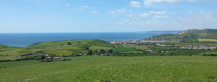
Four areas were visited to give an overview of the Plan area and it was recognised that there are constraints to developing on a large-scale in Bridport, but there may be some opportunities for social housing if suitable, smaller sites can be negotiated with landowners. Magna is in the process of reviewing sites across West Dorset and West Somerset and is including some in Bridport in this process which are not part of the LP or NP reviews.
31 March 2017
Land Use meeting - Economy and Environment
31 March 2017
Present: Andrew Leppard; Maureen Jackson; Richard Freer; Brian Wilson; Gavin Fryer, Phyllida Culpin
1. Reason for meeting
AL explained that we need to understand what we might need land for and then landowners can be approached. All transactions with landowners must be recorded and transparent and make no promises.
2. Land requirements
BW reported that there are a few vacant business/employment units and there is high demand especially for the more expensive units. Vearse Farm will bring 4ha of employment land. Potential for more at Pymore Mills and potential mixed development on land at South Street. Planning application for St Michaels has now gone in.
For Environment there is a need to ensure we don’t contradict the policy about maintaining green space. AL to meet with Richard Nicholls and Environment Group. Need to consider local gaps, green space designation and sky line.
15 March 2017
Meeting of Land Use and Environment Groups BANP March 15 2017
Mountfield Offices
present; Maureen Jackson (chair), Andrew Leppard, Gavin Fryer, Sue Fryer, Richard Nichols, Sal Robinson, Horatio Morpugo, Brian Wilson, Nick Grey.
The two working groups aimed to achieve closer collaboration and ensure that any conflicts were resolved, particularly in designating areas for the Neighbourhood Plan.
Prior to this meeting, there were overlapping areas between potential development and proposed areas of protection. This was discussed site by site.
Conclusions.
Site 6. Jessops Av. Not to be pursued- too small to achieve affordable housing. Local Green Space.
Site 11. W of Coneygar Hill. Not to be included- conflict with Landscape Character policy.
Site 12. E of Mangerton Lane. Site boundary to be adjusted to exclude Barrow Hill (SE corner) which is a proposed Local Green Space designation.
Site 13. Watton Hill. Site boundary to be significantly adjusted since parts of the site conflict with a proposed Local Green Space designation, Landscape Character and Local Settlement Gap. The part of the site to be pursued further is the NE section lying to the South of Dodhams lane, mostly within the Bridport parish.
Site 5. Happy Island Way. The western side of the site will be excluded from development where it is proposed as a Local Green Space.
Site 21. Same applies. However access issues and sloping land remain a concern.
Sites 7 and 8 were also discussed. Agreed; environmental impact is likely to be limited if tree planting is implemented (screening).
Additional.
DCC owned land near Flood Lane (currently undesignated) was also discussed. Given the on-going risk of flooding, potential for commercial/ mixed use may be investigated further.
Generally agreed; The limitations of small lanes in the Bridport area would pose a threat to the environment if development was placed inappropriately without due consideration to traffic flow/congestion or optimum accessibility.
February 2017 - site assessments
The Neighbourhood Plan team ran two ‘calls for sites’ for potential development in and around Bridport during 2016 and the resulting submissions from landowners, along with those sites currently being considered as part of West Dorset’s Local Plan review were visited in December by a group of parish and town representatives, council officers and Neighbourhood Plan group representatives.
The views gathered from those visits have been brought together in this report (open below) as a ‘first stage’ assessment. Also attached are the comments received so far from those who visited the sites and have already reviewed this report. It is important to note that at this stage, no decisions have been made regarding any of these sites.
The Land Use group of the Neighbourhood Plan is currently looking at where future development, particularly affordable housing (in light of local need and the new White Paper), could be located and would welcome views on these sites regarding their suitability for such needs. Any options will be subject to public consultation.
Land Use and Locations site assessment s[...]
Adobe Acrobat document [1.2 MB]
27 April 2016
Land Use/ Location BANP vision2030
Working Group meeting April 27th Mountfield
present;A. Leppard. D. Knorpel. Maureen Jackson. G. Fryer. S Fryer
Issues;
1. From info gathered by public questionnaires and the housing group, land for alternative types of housing which locally connected families could more easily access; in particular sites for self-build, custom-build, rented, and low impact, are to be found urgently.
It is recognised that Low Impact development can be achieved in areas otherwise thought unsuitable (such as sloping land etc). However, consideration to viability, achievability, and overcomming constraints must be made at an early stage.
A Review of Available Land will be initiated as follows;
Tasks;
a). A new call for land (more upbeat) to be issued in local press with photo. (AL)
b). Request to WDDC to contact list of 'Interested Parties' and 'Excluded Development Sites'.
Jo Witherden was suggested as the best person for this task.
c). A study of all (and surplus) land owned by local authorities in BANP area (DK)
d). An inquiry into land stockpilled or unused by housing associations in BANP area (SF)
(eg; Magna owns an unused site off St Swithens Rd)
e). Request for 'Empty Property Register' (MJ)
f). Direct enquiries to known landowners who have expressed an interest (AL)
g). A summary of all land currently proposed which contribute to 5 year land supply. (GF)
2. The Local Plan 2016 staes that land for development is hard to find and with a possibility of 760 new homes at Vearse Farm not being achievable, it is essential to provide alternative sites which
may not have the same high level of impact on traffic congestion, local infrastructure, and flood risk.
It was agreed that potentially, land within the eastern corridor from Bridport, and possibly also north of Gore Cross were most favourable in general. In 'Excluded Development Sites' register, 6 sites have been noted as potentially helping to provide a significant part of the land availability needed for the '5 Year Supply', being between 2 and 9 hectares.
Some initial examples of sites with significant potential;
Brid 36 -North Gore Cross, Brid 43 -Lee Lane, Brid 46 -Mangerton Lane, Brid 81 -N Flaxhayes,
Brid 73 – East Rd, B14 – Dodhams Lane, etc
Tasks;
a). A large paper map will be devleloped to illustrate potential areas for different future land uses.
b). We would request some assistance from Jo W on reading map grid references and codes.
c). Sal R has volunteered to assist with online mapping once information has been clarified.
d). A meeting with WDDC Local Plan team should be proposed in anticipation of 2018 Review.
Next meeting; Monday 9th May Mountfield committee room.
January 2016
Land Use and Location BANP
Summary January 2016
current members; Andrew Leppard, Steven Sherlock, Dominic Knorpel, Patricia O'Neill, Chris Savory, John Hinsley, Nicky Lewis
We failed to meet in January due to various misunderstandings. Apologies.
New; Significant flooding was reported at Vearse Farm on 22nd January. Objections to the application from the Environment Agency the Highways Agency, BTC and increasing concerns from local residents give our group an urgent need to identify alternative development sites which could help to accommodate the allocation of new built houses in the Bridport area.
While a call for sites has so far produced only one response we will be re-visiting the list of 'Excluded Development Sites' from the Local Plan.
In light of the problems of traffic congestion and flooding likely to be caused by large scale developments in areas with high run-off to rivers and insufficient road accessibility, it is believed that local expertise will help provide additional and more appropriate, smaller scale sites.
The Northern and Eastern sides of the area are thought to be the least problematic regarding detrimental impacts to the Bridport area.
Bothenhampton and Walditch are outlying villages that would in particular benefit from regeneration through development including encouraging better services and economic activity.
Land should be identified for the potential provision of low impact development, self-build, kit-build, small holdings, cabins, eco hamlets etc.
Access to Bridport town center has already become difficult due to congestion and lack of parking. The protection of existing central car parking is recognised as essential to residents, visitors, local businesses and shops.
Land Use/ Location will be developing policies with the use of various maps.
2 December 2015
Land Use and Location.
Working Group Meeting Dec 3rd, 2015
present; Andrew Leppard, Ian Harvey, Steven Sherlock, Dominic Knorpel
Tight deadlines may be unrealistic- Land assessed by mid Feb? Identify opportunities first.
Call for land in press. Needs description of particular need and limitations- first task next Thursday.
Agreed; We are looking for land provision for a minimum of 75% low cost for local families.
25% maximum of total development for open-market housing. Confer with Housing Group.
New Development Land to include specialist provision for;
small holdings, custom-build, self-build, low-impact, co-housing, cabins, off-grid, and eco-hamlet potentials. A pilot project of this kind would be encouraged.
New housing land should have reasonable access to uncongested existing roads.
Dominic to circulate Ecological Land Co-ops info to both housing groups.
Support recognised to re-populate and enhance villages for sustainability and improved services (esp; Bothenhampton, Walditch, Bradpole and Symonsbury).
The designation of Exception Sites may facilitate these aims.
There is a desire to revisit the rejected development sites (Local Plan) and apply local expertise.
Through the principles of Localism, we believe that shared knowledge and ideas are essential and therefore we should be justified in approaching specific landowners to seek maximum potential for appropriate growth.
We are developing a map to illustrate various aspects of land use by colour coding including;
flood zones, conservation areas, protected green spaces, potential housing land, potential land for commercial use, retail, recreation, transport facilities, traffic flow, and public parking provision.
For public awareness, including the BANP website, we must present a description of the Group's aims and objectives. Here is a proposal to get us started;
Objectives;
To establish where are the most appropriate and realistic sites for different types and scale of development could be achieved in the BANP area.
To establish which areas within the BANP are most in need of protection from significant change of use or disruption of any kind.
To help provide additional sites for the provision of appropriate housing needed locally.
To help facilitate the optimum spatial layout that would improve access to facilities.
To ensure that the vitality of the town centre or village centres are not threatened by congestion or lack of parking.
Please add or alter any of this asap for imminent posting- thanks
next meeting; Thursday 10th 7pm Mountfield
Andrew
Address:
c/o Bridport Town Council
Mountfield
Rax Lane
Bridport
DT6 3JP
Get social with us.
#BridportPlan
Follow me on:
